This is where I started — though it wasn't this map I had a problem with so much as all of them. vynr's maps were thin.
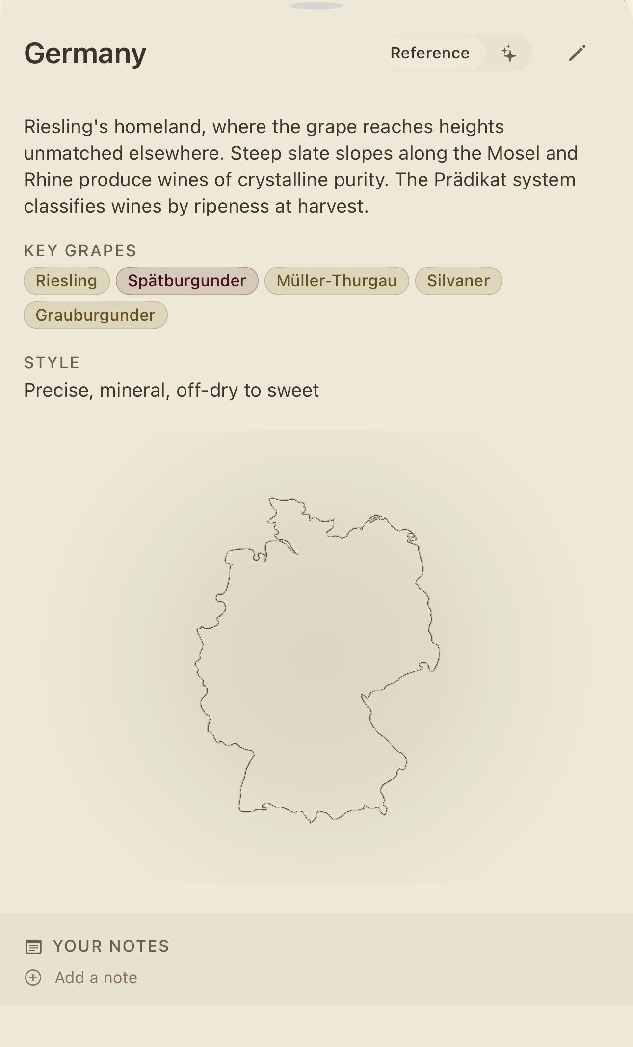
You'd tap into Germany and get an outline. A correct outline. A lonely one. No seas, no neighbours, no sense of near. It told you the shape of a place and nothing about why you'd ever want to be there. A coastline waiting for a country.
You could not tell, looking at it, where the wine in your hand had actually come from — there was no mark, nothing to point at and say here. And vynr is supposed to be an atlas — the kind of book you open and fall into — not a database that happens to draw borders.
The café
A café in Singapore — the one I go to when it's too early for the wine bar. Two cortados, the second one a habit, not a decision. Outside, the heat sat on the street like a hand. Inside, cold air and a graph-paper notebook, and the small, specific happiness of having nothing to do but think about wine.
So I drew it. Pen, graph paper, no undo — which is where every honest idea starts.
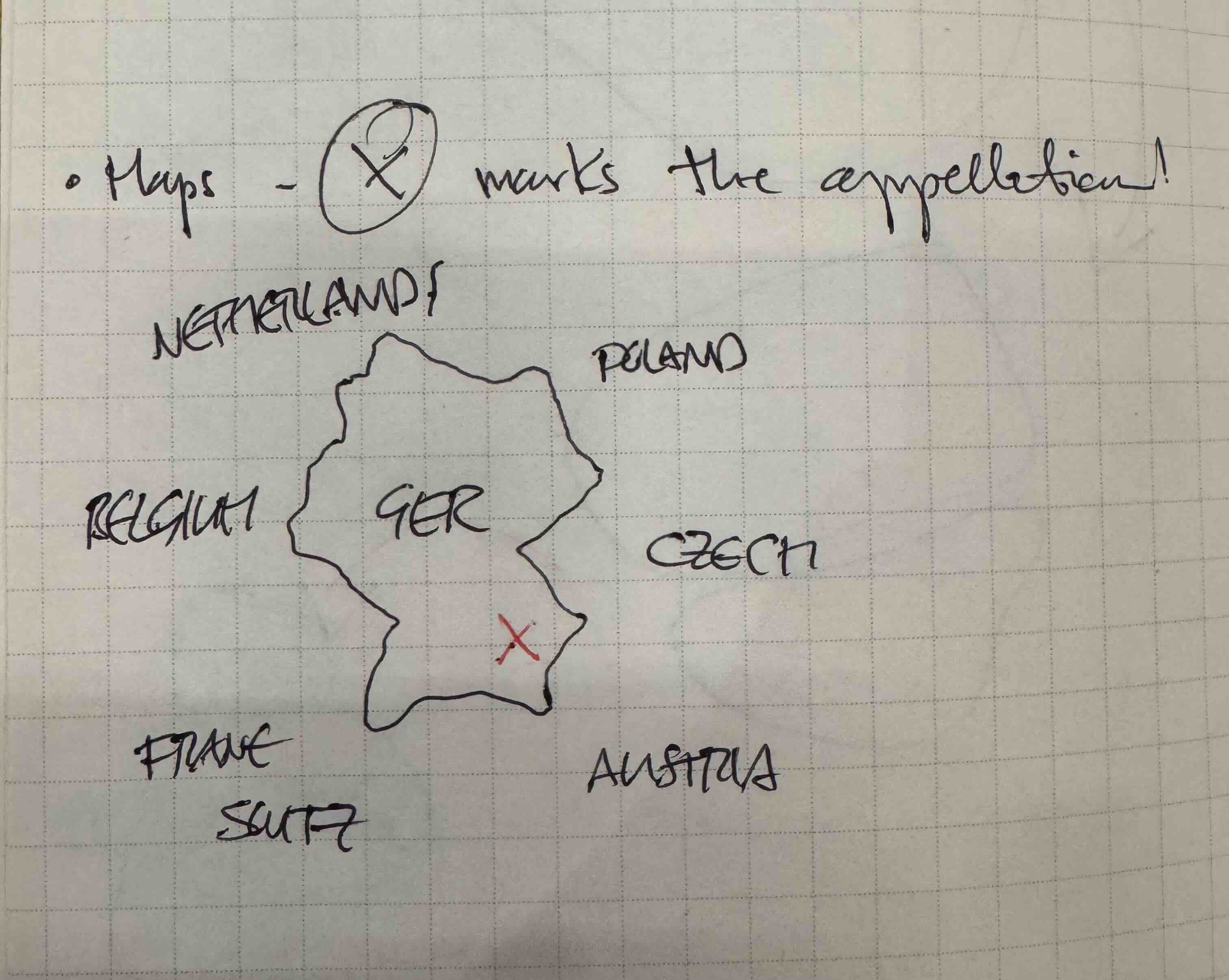
Maps — Ⓧ marks the appellation.
That was the whole thought. A country, its neighbours named the way a child names them, and a single red X to say: here. this exact place. this is where your wine comes from. Belgium, Poland, Czech, Austria, crowded in around the edges. Germany in the middle. An X on the Mosel.
The sketch already knew more than the app did. That's the thing about a café and a pen — you draw what you mean, not what's easy to render.
Bringing it to life
Back home, the work was making the screen feel like the notebook. Aged paper. Soft graphite borders. The neighbours back where the sketch put them. The seas labelled in a quiet italic, because an atlas always tells you which water you're looking at.
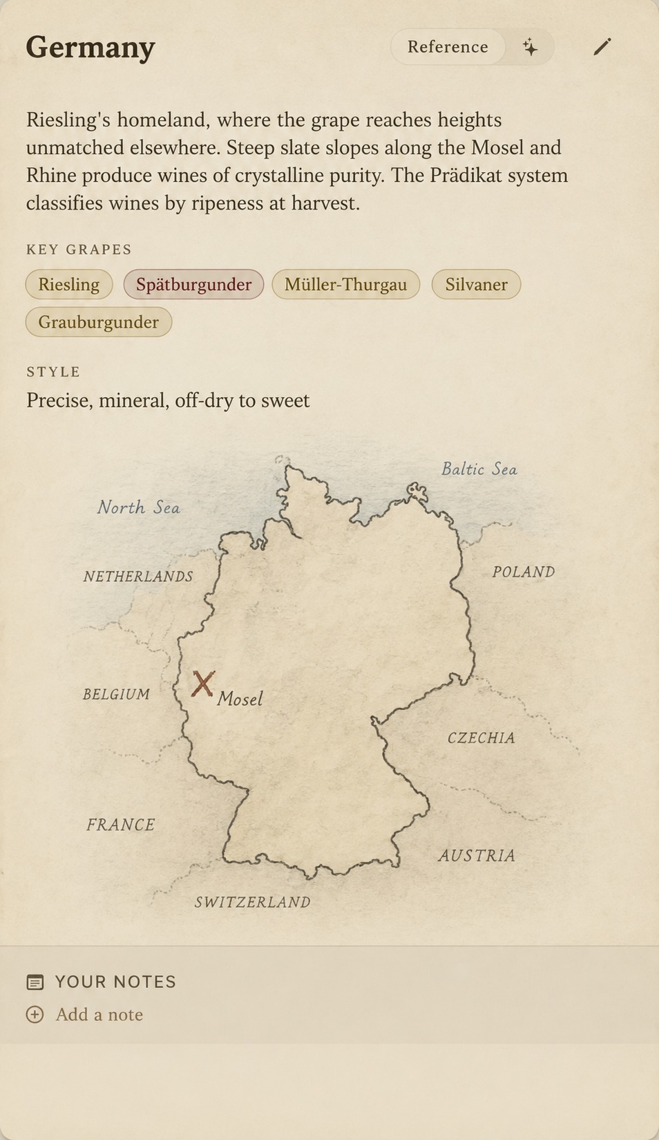
The North Sea and the Baltic. Netherlands, Belgium, France, Switzerland, Austria, Czechia, Poland — a country held by its company. And then the X. Hand-placed, slightly imperfect, sitting right on the Mosel with its name beside it. The notebook idea, kept exactly: X marks the appellation.
The first time it rendered I just sat there. It had crossed over from information into place.
The final shape
Then down one level, into the Mosel itself — and the map had to change voice again. Not a country with a mark on it, but a region with an outline of its own.
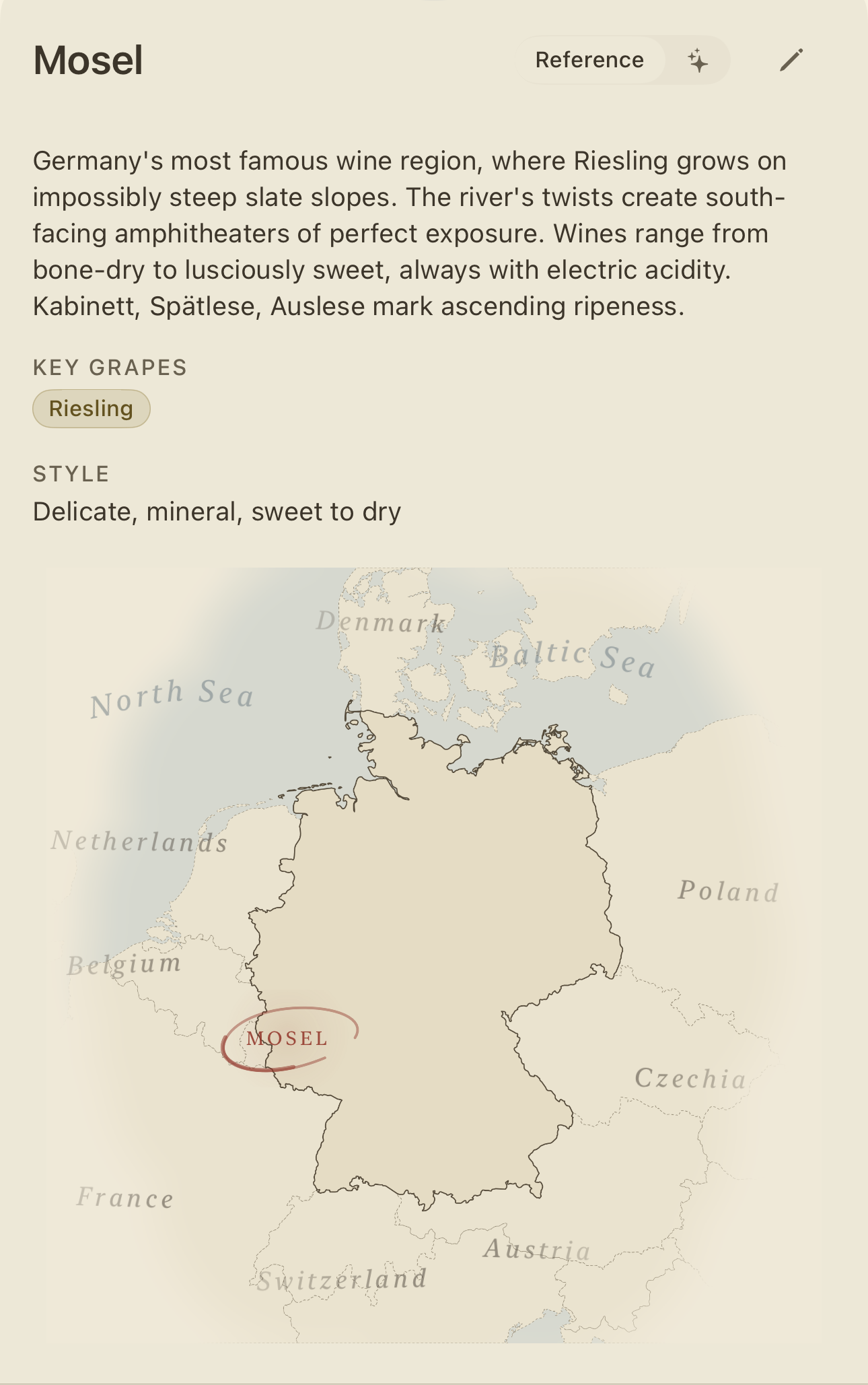
A softer relief, the seas washed in pale blue, Germany receding into its neighbours the way a real map fades toward its edges. And the Mosel drawn not as a dot but as a ring — a hand-circled loop, the way you'd mark your own copy of an atlas with a pencil, saying don't forget this one. Delicate, mineral, sweet to dry. Riesling on impossibly steep slate.
That's where I stopped. Not because there's nothing left — there's always something left — but because it finally felt like a page you'd want to linger on. The bare outline had grown up without losing what made the idea worth keeping.
Two cortados in —
a country drawn by hand,
and one red X
From an outline to an atlas. X marks the appellation.